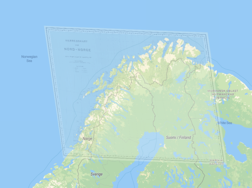
I used the David Rumsey Georeferencer to geo-reference a 1959 map of Northern Norway. It was a bit difficult because the map was in Norwegian, a language that I don’t speak, and at first I didn’t know what place the map was portraying at all. It took a bit of Googling and zooming in to get started, but once I started to connect points it got a lot easier.
I can imagine that with the georectified map, it will be much easier to zoom in and find specific places while not losing your place on the map overall. I also think that scholars could use the referenced map in order to compare data about where big cities have developed and if there are any major changes to the land and waterways. The next steps would be to make the map more widely available and searchable online.
I think the main problem was that the map wasn’t totally accurate. As you can see from the picture, the original map had to be warped in order to line up correctly with the modern map. I also think there are challenges with forcing historical artifacts into a modern lens in general, so it is important to make sure the original maps are being considered on their own as well.
This geo-referenced map would probably not be appropriate for modern geogrpahy, seeing as the map had to be warped which raises some questions about its accuracy. Research questions such as “Where is ___ river?” or “How much of Northern Norway is on the coast?” could probably be better answered with a modern map.
This process did change my understanding of the spatial DH projects I explored earlier because it was so surprisingly easy. Of course, I recognize that it probably took a lot of work to set up the website, but I think it just shows that crowdsourcing can really help with these types of projects.


I completely agree with you that the georeferenced map will make it much easier to find specific places without losing the overall context of the map, and scholars could use it to compare data about the development of big cities and land changes over time. It’s also important to consider the challenges of forcing historical maps into a modern lens, and I appreciate your thoughts on making sure the original maps are being considered on their own.
It’s interesting to hear that the map wasn’t totally accurate and had to be warped to line up correctly with the modern map. I think you’re right that modern research questions could probably be better answered with a modern map, but it’s still fascinating to see how much crowdsourcing can help with spatial DH projects. Thanks for sharing your experience!