Lab Week 5
My CSV spreadsheet and my map While I was making this map, I was thinking
My CSV spreadsheet and my map While I was making this map, I was thinking
Link to map Link to spreadsheet data When I was making this map, I was
This lab features work using the ArcGIS platform. In this lab I select 5 places
Link to map of Northfield What possibilities do you see once you have a georectified
The location, latitude, and longitude data are in this spreadsheet. It was relatively easy to
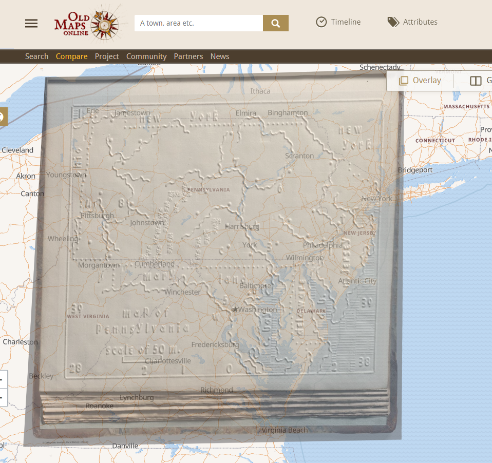
https://davidrumsey.oldmapsonline.org/maps/74fe3c11-1792-5926-8016-c1290f59df4b/ I luckily had a pretty easy map to georecify, being one of an embossed
Once geo-rectified and overlaid on a modern projection of the earth, the historical map is
This lab is to create a custom campus map using ArcGIS to show my frequent
Spy glass on plotted Carleton College Grounds 1941.